Kilitbahir Fortress
castle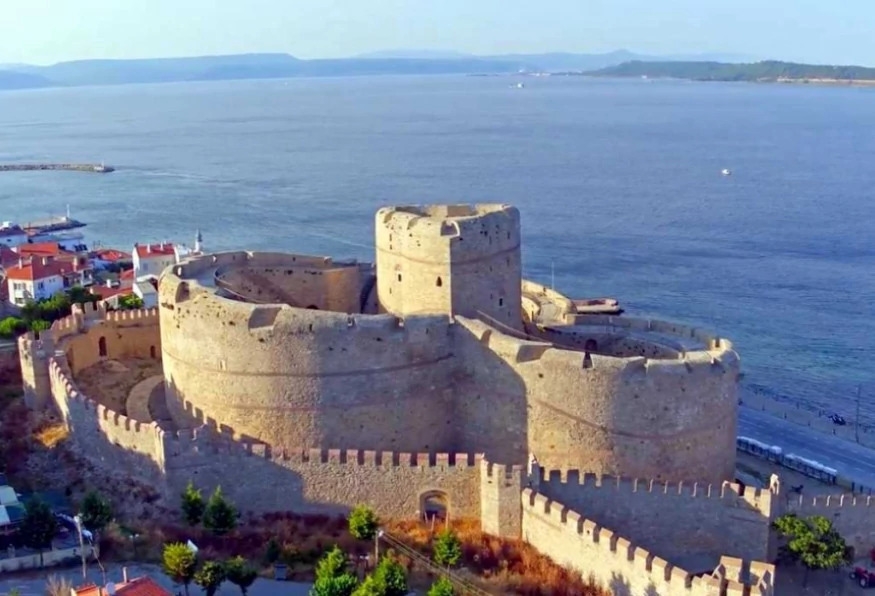
Kilitbahir Fortress, also known as Cimenlik Fortress, was built in 1452 on the European side of the Dardanelles, opposite the Kale-i Sultaniye, also known as Cimenlik Fortress. While giving the building order, Fatih the conqueror was aiming to block European countries from assisting the Byzantines during the siege of Istanbul.
Sultan Selim III and Suleiman the Magnificent strengthened the fortress. It resembles a three-leaf clover with its form and is 220m in length and has three bridges.
Because he formerly served for the Sultan in this castle, a piece of the fortress has been dedicated to the remembrance of Turkish sailor Piri Reis, the cartographer of the first world map that matches precisely with modern ones.
-thumb.jpg&w=1920&q=100)

